OpenForest4D will implement two distinct data and processing workflows – one that processes airborne lidar scanning data to produce grid-level and tree-level forestry products and another that utilizes spaceborne remote sensing data to produce grid-level upscaled wall-to-wall forestry products.
Airborne laser scanning (ALS) derived products
OpenForest4D will enable processing of ALS lidar data from USGS 3D Elevation Program, NOAA Coastal Topographic Lidar, NSF OpenTopography and other sources to produce grid-level products like digital surface models and canopy height models. The platform will enable users to detect and analyze the spatial distribution of forest canopy gaps and calculate additional grid-level metrics at the landscape scale over the user-selected spatial resolution.
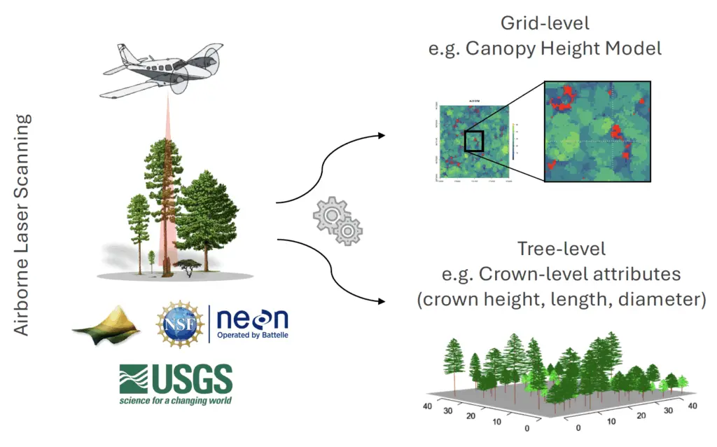
OpenForest4D will also enable processing of ALS lidar data for tree-level products including crown-level metrics which can be used to estimate forest attributes and assess individual tree spatial distribution and forest uniformity at the tree level.
Spaceborne remote sensing derived products
OpenForest4D will enable users to produce wall-to-wall forest attribute maps (e.g., above ground biomass, canopy height and cover) at 30-meter resolution by combining and upscaling spaceborne remote sensing lidar data (e.g., NASA GEDI or ICESat-2) with either optical data (e.g., Landsat 8 OLI or Landsat 9) or synthetic aperture radar (SAR) data (e.g., Sentinel-1C).
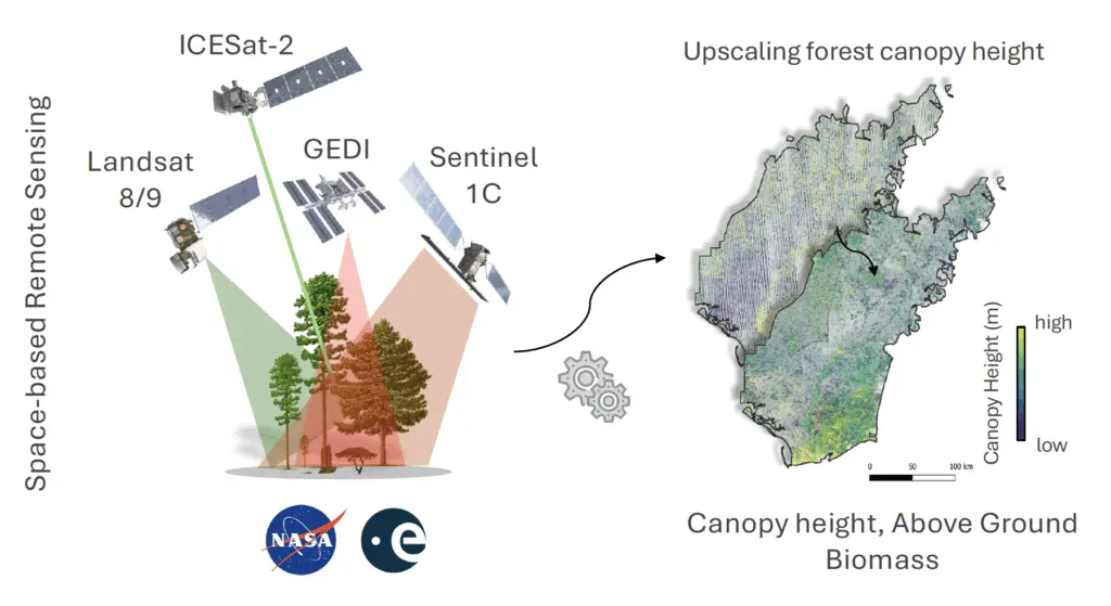
The process will be guided by an assessment of the most suitable data fusion scenarios and will utilize machine learning and statistical modeling approaches.
Related: